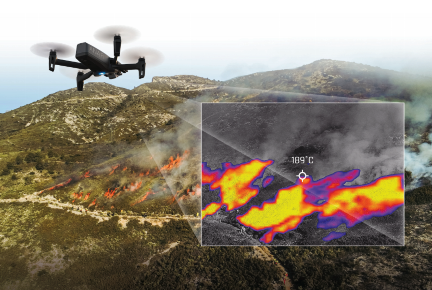
A Closer Look from Above: Unraveling the Real-World Applications of Thermal Imaging via Drones
The integration of thermal imaging with drone technology has unfolded a myriad of applications that transcend the conventional boundaries of aerial inspections. From ensuring security perimeters to wildlife conservation and energy inspections, thermal drones like the DJI Matrice 300 RTK paired with radiometric thermal cameras like the Zenmuse XT2 have carved a niche in delivering detailed, accurate, and instantaneous data.
A Glimpse into the Technology
Thermal imaging, at its core, is the technique of using the heat emitted from objects to render an image, showcasing temperature variances. When mounted on drones, thermal cameras leverage the aerial perspective to capture comprehensive and detailed thermal data over expansive and often inaccessible terrains.
Surveillance and Security
Security personnel are harnessing drones equipped with thermal cameras, such as the Parrot ANAFI USA, to enhance perimeter security and intrusion detection. The ability of these drones to capture heat signatures, even under complete darkness or adverse weather conditions, is revolutionizing the way security protocols are implemented, ensuring real-time responses to any intrusions.
A Parrot ANAFI drone, capturing thermal images to ensure enhanced security measures.
Wildlife Conservation
In the realm of wildlife management and conservation, thermal drones are the unsung heroes. They can monitor and track animal movements during the night, offering invaluable data to wildlife researchers. For instance, the FLIR Vue Pro R, with its radiometric thermal camera, has been instrumental in studying nocturnal animal behaviors without disturbing their natural habitats.
Energy Sector Insights
The energy sector, particularly solar farms and electrical grids, greatly benefits from thermal imaging drones. Drones like the DJI Matrice 300 RTK, equipped with software tools like DroneDeploy, offer detailed thermal imaging that can pinpoint defective solar panels or overloaded circuits, driving maintenance efficiency and ensuring optimal energy production.
The DJI Matrice 300 RTK in action, ensuring the integrity of a solar farm with detailed thermal imaging.
Thermal analysis data plays a critical role in identifying potential performance issues or other maintenance related concerns before it’s too late.
Search and Rescue Operations
In search and rescue missions, time is of the essence. Drones equipped with thermal imaging technologies ensure that search teams can locate lost or stranded individuals by detecting their heat signatures. Software applications like Pix4Dfields process this thermal data, ensuring real-time analytics that can often mean the difference between life and death.
Firefighting and Disaster Management
Firefighters and disaster response teams are employing thermal drones to assess and mitigate risks. For instance, the Autel Robotics Dragonfish, with its dual-sensor thermal payload, offers real-time insights into fire propagation patterns, aiding firefighters in strategizing their containment efforts effectively.
Building and Infrastructure Inspections
The construction sector is leveraging thermal drones for structural inspections. These drones can quickly identify insulation leaks, water seepages, or structural weaknesses, facilitating prompt remediation. Software like ThermalCapture Fusion Zoom processes and analyzes the thermal data to provide actionable insights to the construction and maintenance teams.
A thermal drone identifying insulation inefficiencies in a commercial building.
Agricultural Efficiency
In agriculture, drones like the DJI Agras T20, equipped with thermal imaging, are used for crop monitoring. They can identify irrigation issues, pest infestations, or unhealthy plants by analyzing the thermal signatures, enabling farmers to take targeted actions to enhance crop yield.
The DJI Agras T20 working to ensure optimum crop efficiency and health
Concluding Remarks
The incorporation of thermal imaging in drone technology has indeed opened up avenues previously unthought of. As technology continues to advance, the precision, efficiency, and applicability of thermal drones will only grow, marking them as indispensable tools in a plethora of sectors. For professionals and enthusiasts alike, keeping an eye on the thermal skies is not just intriguing – it’s essential.
Sky360° Aerial Media is a leader in professional drone services, delivering professional aerial imagery and detailed data collection. We provide a true start to finish solution including flight planning, aerial imagery, data capture with advanced processing and analytics enabling our clients to capture maximum value and critical insights.
Learn More: www.sky360aerial.com
About the Author
Scott Thomas is a champion of innovation and practicality, a vital asset at Aetos Imaging where he's dedicated to expanding the reach of their cutting-edge 3D imaging platform, Operate. His strategic thinking has solidified Aetos Imaging's position as the premier toolkit for facility managers and maintenance teams harnessing data for optimum building operations.
Scott also heads Sky360° Aerial Media as CEO and Director of Flight Operations, where he skillfully combines cinematography and advanced drone technology.
His forward-looking perspective makes him a respected voice in the UAV and drone sectors. His writings delve into the intricacies of 3D imaging and explore the extensive potential of UAVs in today's dynamic business environment, providing valuable guidance for professionals striving to keep pace with rapid technological advancements in facility management.


